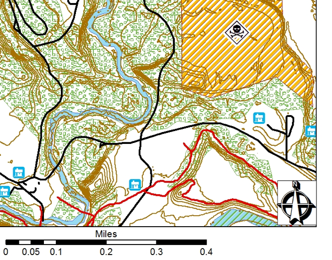
Here is a snippet of the maps racers will be using for the orienteering sections of END-SPAR this year. The contour intervals are every two feet.
The course is 80% finalized. Here's a look ahead. There will be 10 mandatory checkpoints that racers must reach in order to be considered finishers. In addition to these CP's, there will be 5 optional sections, each with three optional CPs. Teams will be ranked first on how many optional CP's they get and then on time. More details will follow in the race rules which will be posted this week on the main race page.
Each optional section can be completed in full or in part, but must be done so at the specified time during the race. For instance, if you decide to pursue the 'riverwalk' CPs, you must do so after the opening trek and before beginning the first bike leg. You will not be allowed to try to get these CP's later in the race. Time management will play a key role a teams strategy, as some optional CPs will be easier to reach than others.
The five optional sections will include:
1) River walk - three CP's will be placed on a specified stretch of river but not marked on the map. Teams trying to get these optional CP's can get them in any order. All river walk CP's will be team punches, meaning the ENTIRE team will have to physically visit the CP and punch their wristband for it to count.
2) Mystery Challenges. Each Challenge will count as one CP. One challenge is mainly physical, one is purely a skill, and the third has both skill and physical elements to it. The physical challenge is fairly difficult but is directly applicable to many adventure racing situations. The other two challenges are wilderness skills. Teams will get ONE shot at each challenge they choose to attempt. Failure means the team cannot get credit for the CP.
3) Foot Orienteering. There will be an optional foot orienteering section consisting of three points. racers will be given a contour map and UTM coordinates of the points. Although trails exist in the area, they will not be included on the map, forcing teams to navigate proficiently using land-forms.
4) Sunken Treasure. There will be three CP's that require use of packrafts. Some (but not all) of these my be located beneath the surface of the water and difficult to see until you are within a few feet of their location. Good navigation will be key.
5) Bike Orienteering. There will be a bike orienteering section with three points. teams will NOT need to plot these points using UTM coordinates. Teams pursuing these points will get to ride on some of the more technical trails in TRSP, which truth be told, aren't very technical if you've done much mt. biking. The trails might include fast and flowing single track between trees and on slopes.
Again - rules and details about gear drops/gear bins will be forthcoming this week.
Happy training everyone!
Comments
Andy -- number 3 implies racers must plot their ow...
i don't want to give too much away... but lets...
Add new comment